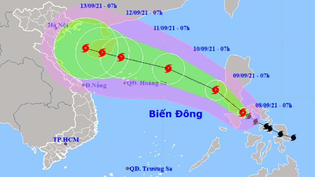
At 07am on September 8, Conson was churning outside the central region of the Philippines, packing winds of between 75-90kph near its eye, reported the National Centre for Hydro-Meteorological Forecasting (NCHMF).
In the next 24 hours, the storm move north-west into the East Sea at a speed of 10-15kph, said the centre.
In the following 48-72 hours, Conson is forecast to retain its direction toward the northern coast of Vietnam and likely to gain strength further, with winds gusting up to 120kph near its centre.
It is anticipated to make landfall on September 13, causing rough seas and heavy rain.
The National Centre for Hydro-Meteorological Forecasting has raised the warning level of disaster risks in the areas to be hit by the storm.